
About a week ago, I finally made a special trip to go explore the wetland. I was really surprised by the amount of habitat that's squeezed into the area's borders, and by the number of plants and animals I found. I'll take you along on my walk by posting some of the pictures I took, but first, here's a little map I made showing a good place to park, and the approximate locations and routes of the trails. (Click the link below the map to see more details and trail descriptions.)
View Minthorn Springs Wetland in a larger map
The protected wetland area is bordered by the office complex on two sides, a railroad and residential development on one side, and by SE 37th Avenue and the Milwaukie Marketplace shopping center on the other side. Besides the protected habitat area, there is a link to a pond at Milwaukie Marketplace, and a drainage channel along Hwy 224, which flows in to the wetlands. After the water leaves the wetlands, it flows behind our office building and through the complex, creating more areas where the geese like to hang out.
In the maps below (created using the Oregon Explorer Advanced Mapping Tool), you can see the current wetlands in dark green. Water from the wetlands flows SE through the industrial area to Mt. Scott Creek. From there it turns SW, joins Kellogg Creek, then flows NW to Kellogg Lake and the Willamette River.
 |
| Map showing current wetlands and water flow (click to enlarge) |
At the edge of the pond in Milwaukie Marketplace (between Sheri's and McGraths Fish House) there is a sign that says that the wetlands were once a main channel floodway for the Clackamas River, and that the area was used by Indians and pioneers. That got me wondering about what the area looked like before parts of the wetland were filled for development. The map below shows the current wetlands as well as historical forested and emergent wetlands. The areas outside the historical wetlands (the light background color), are shown in the data as "prairie".
 |
| Map showing current and historical wetlands (click to enlarge) |

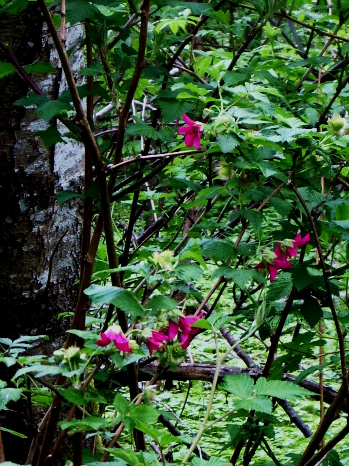
 |
| Red-flowering currant (center) and Vine Maple (top left) |

At the spot pictured above, where the water takes a step down as it flows toward the outlet, I saw Red-winged blackbirds in the grasses in the background, and my first Yellow-rumped Warbler (Myrtle form) was flitting around in the foreground trees. I couldn't get a decent picture of either of them.
The story continues after the jump...
 |
| Canada Goose |
 |
| Mallard pair |
 |
| Canada Geese with goslings |
There were lots of Canada Geese, goslings in tow, along the South Edge Trail. The parents hissed at me as I tried to walk slowly and quietly around them.
After making it to SE 37th, I decided to go take a picture of the pond at Milwaukie Marketplace.

 |
| Minthorn Springs Pond with Hwy 224 in the background |
Then I walked up 37th to the wetlands access point, pictured below.


I entered the park and turned to the right, along the South Wetlands Trail.

 | ||||
| Evidence of beavers |
I came upon an area covered with a plant that looked like a fern from a distance, but after taking a closer look, I don't think it is a fern.


The leaves look similar to Pacific Bleeding Heart, but I don't think that's it either. This plant was taller than any Bleeding Heart I've ever seen. Anyone know what it is? In the picture below, a Red-flowering currant tries to hold it's ground. Update 6/6/12: I think a visitor has correctly identified this plant as Poison Hemlock (Conium maculatum).


The Canada Geese were everywhere, and they always kept a close eye on me. I ran across a broken egg at one point. The size made me assume it was a goose egg. I was contemplating whether the egg had hatched, been scavenged, or otherwise broken, when I turned around and saw these...

Just lying there on the grass. There was a pair of geese in the water nearby, but not watching me as closely as some of the geese had been. I moved along quickly so whoever the eggs belonged to could return.
That's when I found some fresh evidence of beavers doing their thing.

Unfortunately, there are some things in the wetlands that you don't like to see...

It started to rain lightly as I was headed back to the trail head.

After making it back to the access point, I took the northern trail around the other side of the water. The trail here was pretty muddy, with some areas that were down right swampy (as evidenced by the skunk cabbage below).


 |
| Rubus spectabilis, or Salmonberry |
 | ||||
| Bat house |
 |
| Tracks in the mud |
 |
| Duck house? |
North of the wetlands trail head, there is a fenced off area that's undergoing restoration (Minthorn North). You can view the area from the fence, and there are some more interpretive signs telling about the wildlife that utilizes the wetlands.

 |
| More tracks in the mud |


I spent about an hour in the park, and never saw another person. I had a great time, and I definitely won't wait another 13 years before I go back.
It was sad to see how much trash was in the area. The Wetlands Conservancy manages the site with the help of volunteers. I've sent an e-mail asking about any scheduled volunteer clean-up days. A few people with garbage bags could make a big difference here in just a couple of hours. I'll let you know what I hear.
 |
| The South Edge Trail - wetlands on the left, mini-storage on the right |
Update: February 28th, 2012 - For more recent pictures of beaver activity and a native frog at Minthorn Springs, read this post.
What a wonderful place! And a wonderful blog as well. I am quite enjoying it. Keep up the good work.
ReplyDeletehttp://knowledgeiswonderful.blogspot.com/
I haven't been out to Minthorn Springs in years--back when I did some dragonfly surveys for The Wetlands Conservancy. There were no signs or trails back then. I'll have to make some return visits this summer.
ReplyDeleteThanks for the kind words, Jason!
ReplyDeleteThe signs and access are great now, Jim. It's just sad to see the trash. TWC could use a volunteer party for sure.
As someone interested in native plants and wildlife, I am glad I stumbled across your blog! We have been converting our yard in Beaverton to all native landscaping.
ReplyDeleteHi Shelly - glad you found me! I hope you can find something useful here... or at least interesting. : )
ReplyDeleteNice blog post, Matt! Man, I haven't really walked around there much either---I suppose I should! I liked all of your pictures. And, I am always disgusted by the trash around there--I would definitely be up for a volunteer clean up!
ReplyDelete--Anne T.
Thanks Anne - I think a clean up day may happen. I need to talk to the Conservancy again. I'll let you know!
ReplyDeleteJust in case you are still monitoring this- I visited lately, and it was far too wet to get very far- but there was a homeless encampment in the middle of the park- no one was "home" at the time, but there were tarps and trash and other evidence of habitation. Unfortunately, I don't think that proomised cleanup has happened!
ReplyDeleteSo funny that you made this comment today. My wife and I were just there today, looking at some big trees that are soon to be felled by the beavers (and one came down in the last week). We saw the same encampment.
ReplyDeleteThe cleanup did not happen last summer. I may try to contact the Conservancy again and see if we can get one together for this summer.
Thanks for visiting and commenting!
I think your bleeding heart look-alike might be dutchmans breeches. We're sitting in McGraths waiting for our dinner and trying to figure out if these ponds are man-made; stumbled across your blog. Lots of good info and pix. Thank you for sharing.
ReplyDeleteGary and Reneé
Thanks for visiting, for the kind words, and for suggesting a possible plant ID. Dutchman's Breeches is a great tip, because it does have very similar leaves, but the plants in my pictures are 3 or 4 feet tall. The descriptions I've read of Dutchman's Breeches say that plant is 4 to 6 inches tall.
ReplyDeleteI walked in there last fall and the camp was occupied by a guy sipping an alcoholic beverage so just be aware. Not sure I would go in there alone. But it is a treasure and needs some care. I am really enjoying your blog.
ReplyDeleteThat camp stayed there through the winter and early spring, but it is gone now - cleaned up. It seems like the camps generally stick to the Northern edge of the park, so they can easily be avoided while enjoying most of what the area has to offer. But it is always a good idea to use the buddy system.
DeleteThanks for stopping by - glad you're enjoying it!
I just took a moment to go through my guide to selected weeds of Oregon and I think there is good chance that the unidentified plant is water hemlock or poison hemlock. It would be nice to find out for sure and if it is the poison version, eliminate it.
ReplyDeleteI think you hit the nail on the head with Poison Hemlock. In the pictures I saw online, Water Hemlock's leaves didn't look as lacy, but the pictures I saw of Poison Hemlock were spot on. I returned to this area later in the summer and someone (the Nature Conservancy) had chopped down or pulled a lot of this growth, so maybe there is an active effort to remove it. Thanks for stopping by - and for the ID!
DeleteI've been running along the road (on 37th) bordering these wetlands every Tuesday and Thursday for about three years now, with a couple of dogs. We love to see the geese and their little goslings every year and always take care to stay far away from them as the dogs are especially interested.
ReplyDeleteLast week I was surprised by a huge toad waiting to cross the road, right at the back of St. Vincent's. (I think that's where it was? I never go to the front of these places.) At first I thought it was fake, it was so big - and the dogs didn't notice it. When I stopped and they noticed it was real, we chased it across the street to be sure it landed safely out of traffic. It did, all about 9 inches of it, not including huge long legs!
Sadly, this wetland area is so small and the water is often polluted by plastic bags and as you saw, shopping carts. I don't take the dogs actually through the area, as they scare the birds and that's not cool...I'm very interested in helping with a clean-up if there is one happening!
Hi Jen - thanks for commenting!
DeleteI wonder if that big toad was actually an invasive Bullfrog. http://www.dfw.state.or.us/conservationstrategy/invasive_species/bullfrog.asp
I don't think we have any native frogs or toads which are that large. Pretty funny sight though, I'm sure.
I haven't heard any more from the Wetlands Conservancy as far as organizing a clean-up. If I do, I'll be sure to post here and get in touch with you.
Thanks again!
After numerous wonderful morning visits and removing a bag of garbage each time, two new and rather long term looking "camps" have been constructed in the last couple of weeks.
DeleteAny thoughts on who we should contact? I mentioned it to the Milwaukie police that hang out at the nearby starbucks and they said it was a county parks problem. I've sent notes to the conservancy and never received a reply.
mark
The camps seem to stay for a while when they appear, but eventually get cleaned out (mostly). I think the county might do periodic sweeps. I'm not sure what's there now, but in the past, the camps have stayed mostly to the left of the park entrance, allowing free access to the biggest part of the park to the right. I've never encountered any problems, but it's always good to go in groups or pairs. I never got a response to my last e-mail to the Conservancy.
DeleteGreat blog, Matt. When I was at PSU Geography in the early 90s, we had a seminar on cartography, and our assignment was to teach high school kids to survey and map using compasses, measuring tape, clinometers and the like. This was the area we were supposed to get the kids to map. It was lots of fun, and the wetland looks like it hasn't changed much in 20 years (even the garbage unfortunately, it only gets periodic cleanup).
ReplyDeleteIn the late 90s I worked for Averstar in that complex to the east, and frequently walked in there during breaks and lunchtime.
I most recall the nutria swimming in the channel behind the complex, and the water rights guys who periodically came in and took down the smaller beaver dams to let water through to the land owners downstream.
Good post!
Thanks for the comments and kind words, Richard. I think I remember you from Averstar (if I'm thinking of the right Richard) - I started there in '98. I don't think the wetlands have changed much, but that ditch behind the office sure has. It's full of shrubs and some pretty large trees now. It's pretty amazing how quickly they've grown (and/or how long I've worked there).
Delete